Data
Giving open access to IWMI’s knowledge is critical to our mission. Below is a selection of scientific datasets and other information products.
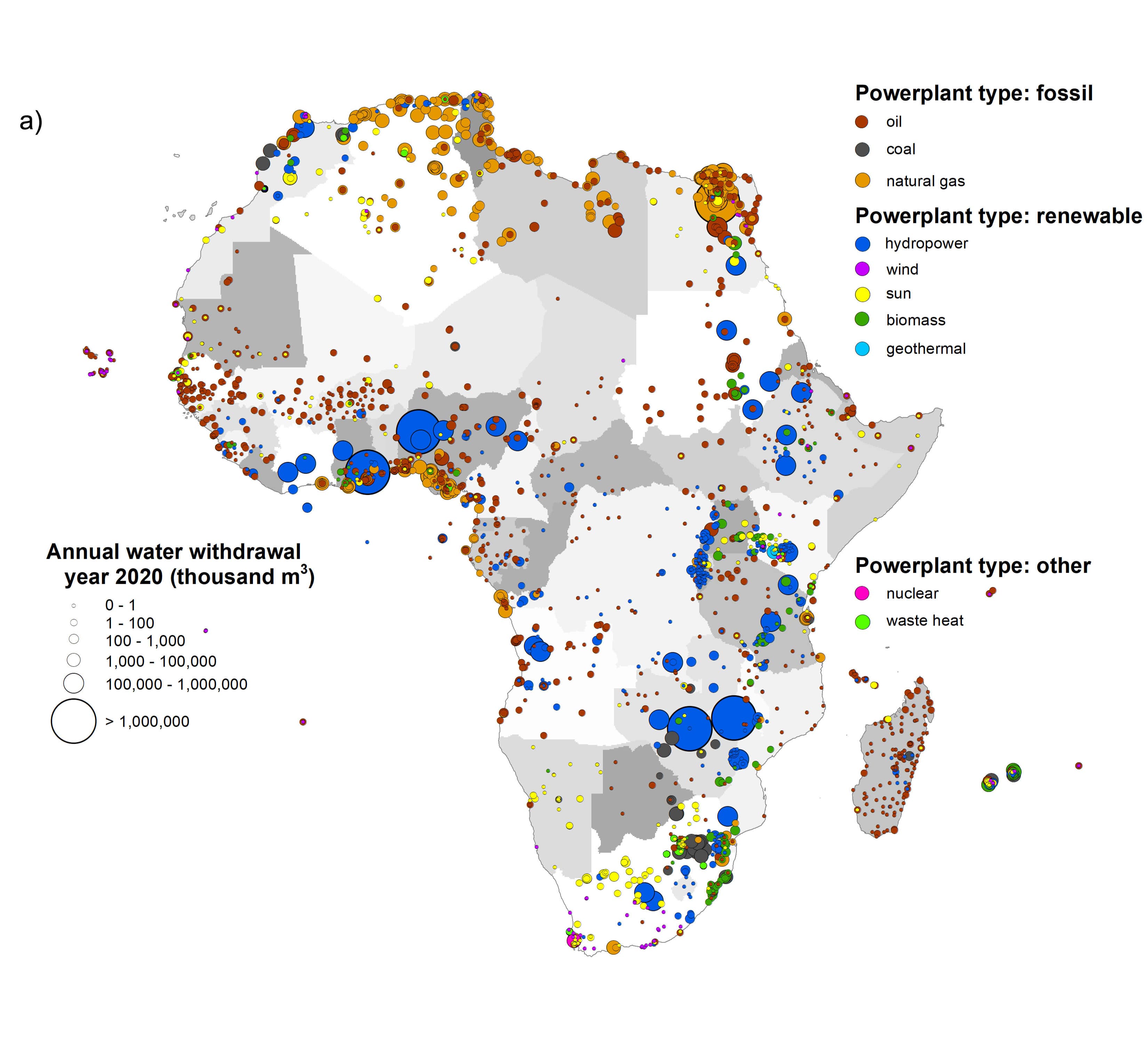
Closing the African data gap
New open access database is valuable for sustainable development in the energy and water sectors …
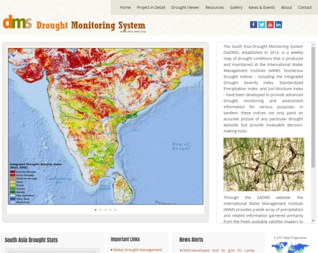
Drought monitoring system
The South Asia Drought Monitoring System (SADMS) is a weekly map of drought conditions that are produced and maintained at IWMI …

Flood risk mapping
Remotely sensed information from satellites and airborne instruments can be used for estimating the extent and dynamics of flood inundation for large areas and can complement in-situ observations …
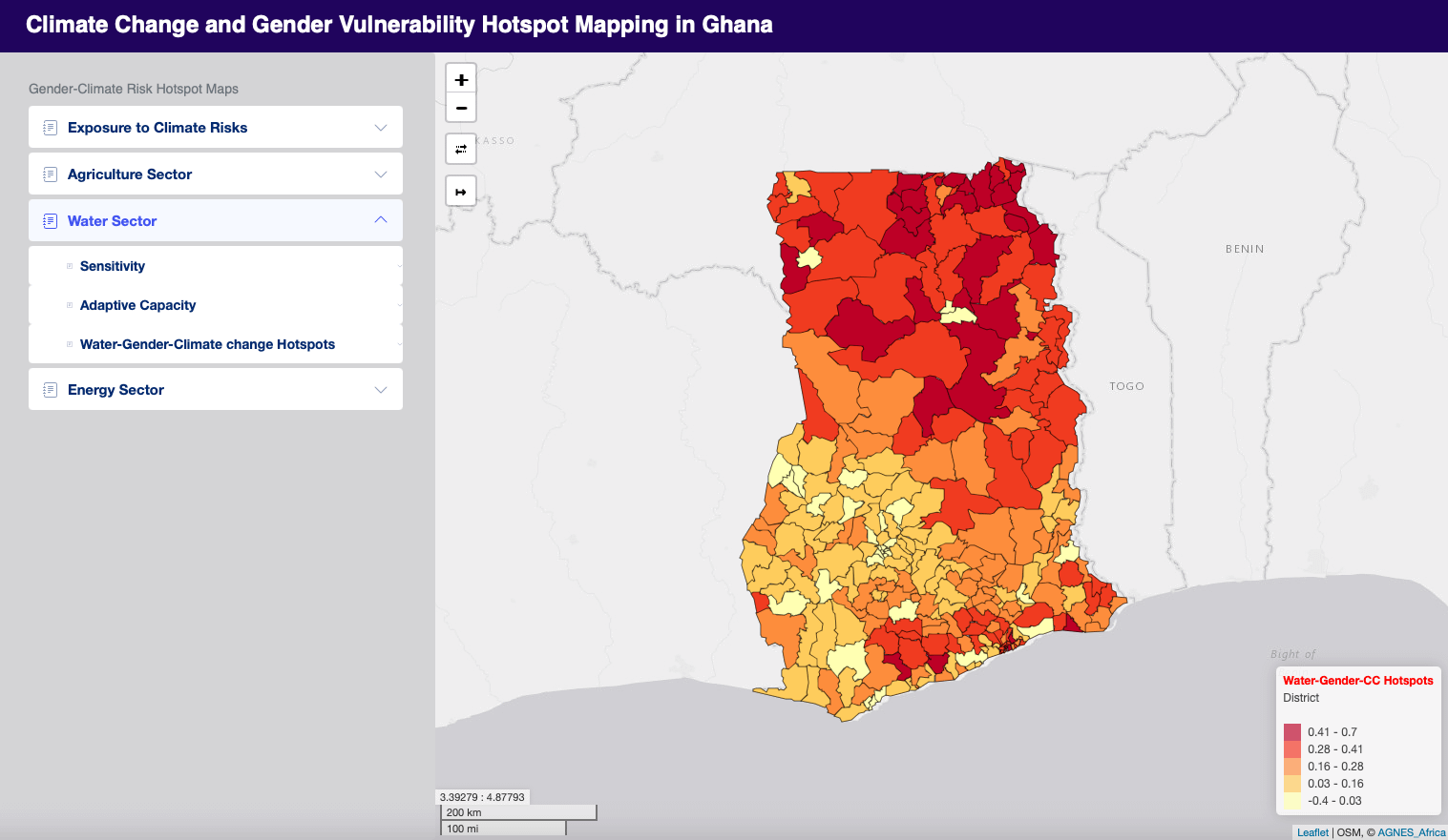
Gendered climate vulnerability hotspot mapping for inclusive action in Ghana
This tool will contribute to informed decision-making which addresses the specific needs of diverse social groups. …
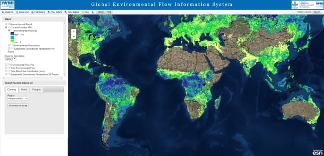
Global environmental flow information system
The interactive maps provide information related to Environmental Flows for the current condition and for the different Environmental Management Classes (EMCs) of a river system …
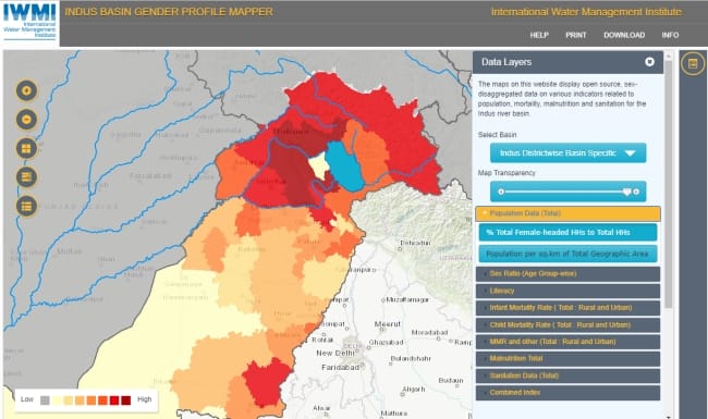
Indus Basin Gender Profile Mapper
The basin maps on this website aim to provide an evidence base for analysis of gender disparities and new development opportunities …

Irrigated area mapping: Asia and Africa
IWMI continues to advance its irrigated area mapping products in regions where it works as technology improves …

IWMI Environmental Flow Calculators
The IWMI Environmental Flow Calculators are a family of software for desktop rapid assessment of Environmental Flows (EFs) …
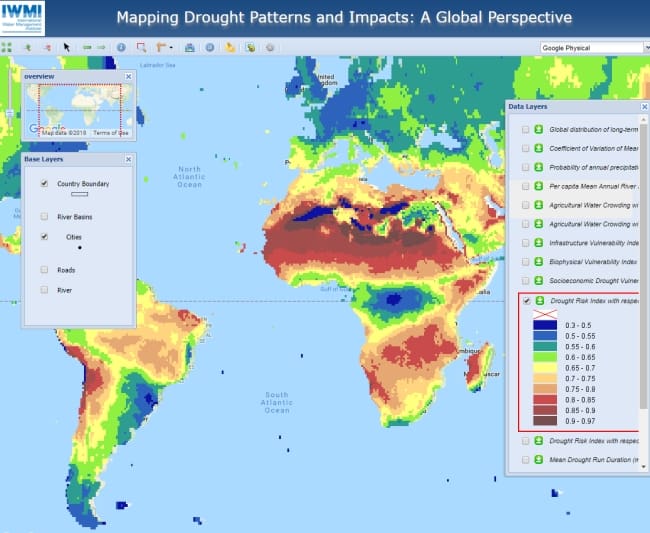
Mapping drought patterns and impacts: A global perspective
This dataset provides global patterns and impacts of droughts with mapping of several drought-related characteristics – either at a country level or at regular grid scales …
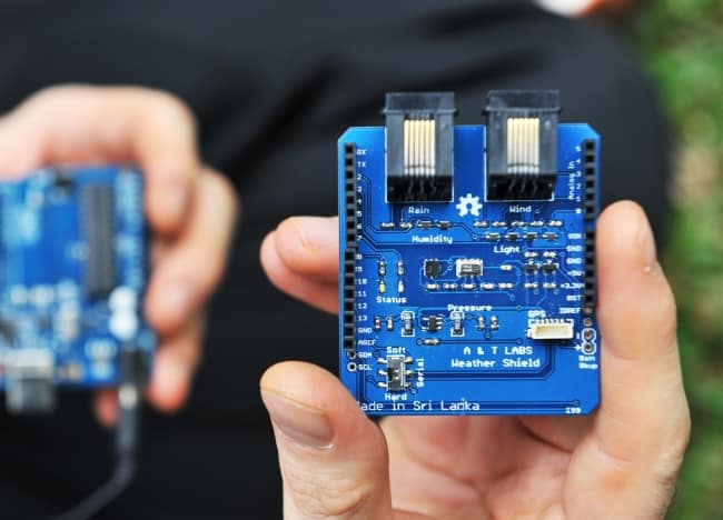
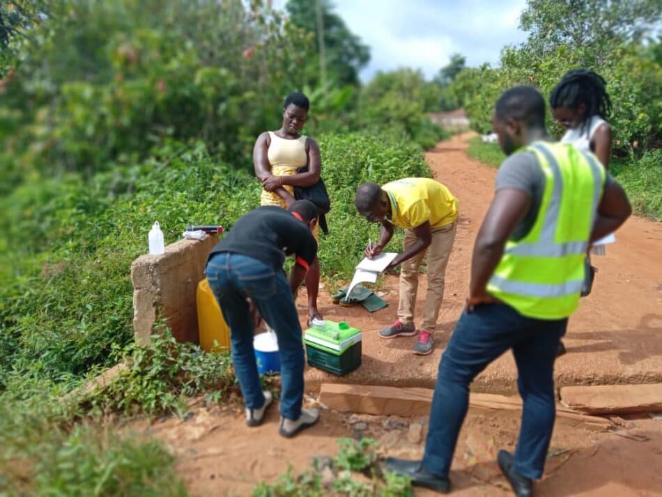
Mobile Weather Stations
Low-cost mobile weather stations are designed to help us monitor the weather more closely …

Sustainable fish farming in Myanmar gets a smart boost
Deployed across 170 townships, IWMI’s Aqua Decision Support Tool guides policymakers and farmers towards climate-resilient, profitable aquaculture in Myanmar …
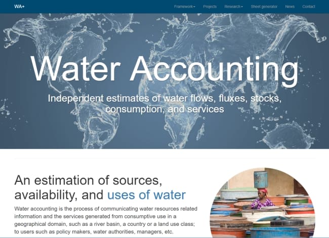
Water Accounting+
The approach uses global hydrological models and public domain remote sensing datasets to analyse the water flows, fluxes, stocks, consumption, and services from complex river basins …
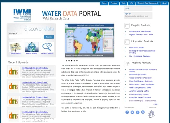
Water Data Portal
The Water Data Portal is a one stop shop to access all IWMI research data …
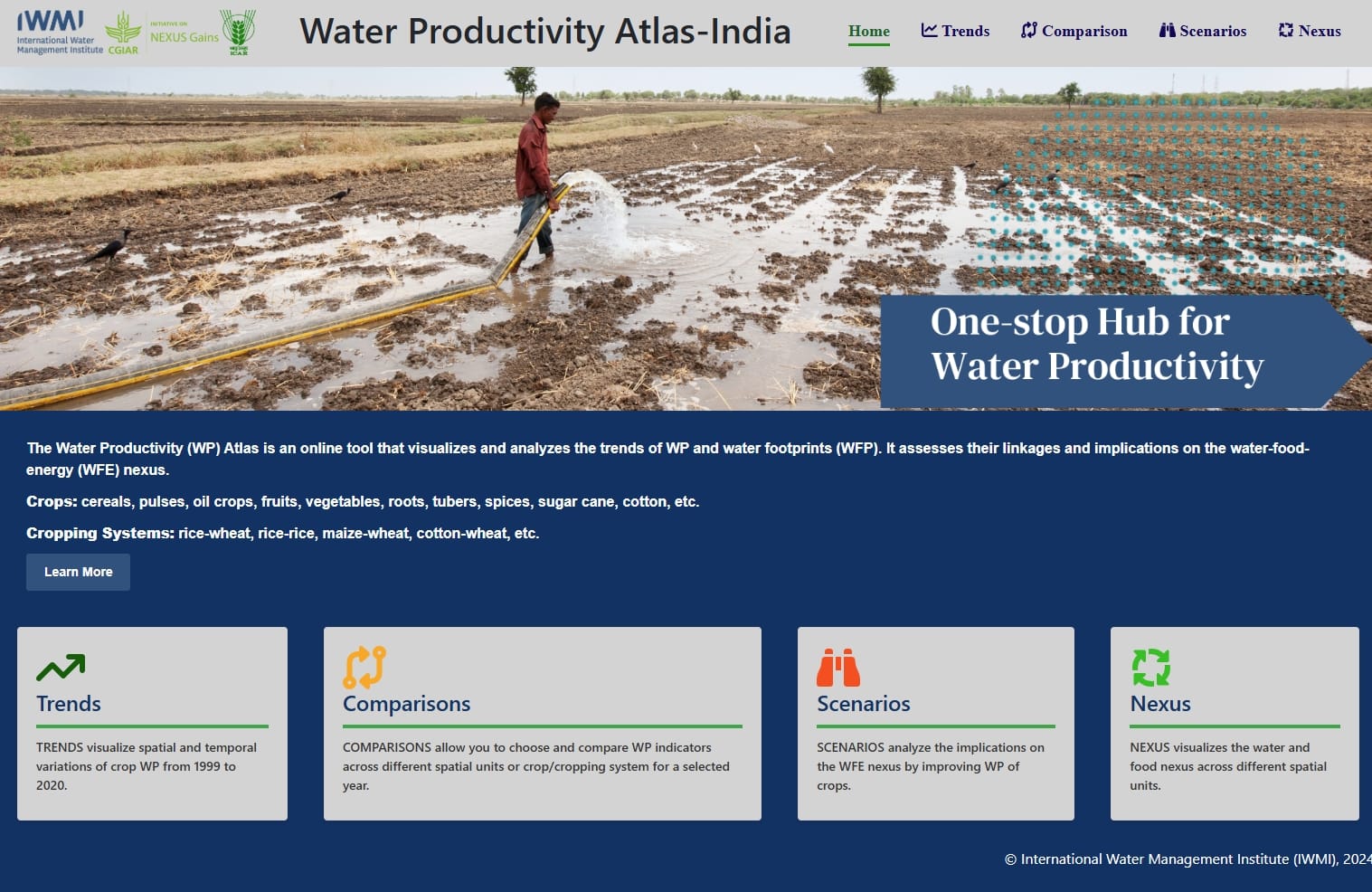
Water Productivity Atlas India
The Water Productivity (WP) Atlas is an online tool that visualizes and analyzes the trends of WP and water footprints (WFP). It assesses their linkages and implications on the water-food-energy …