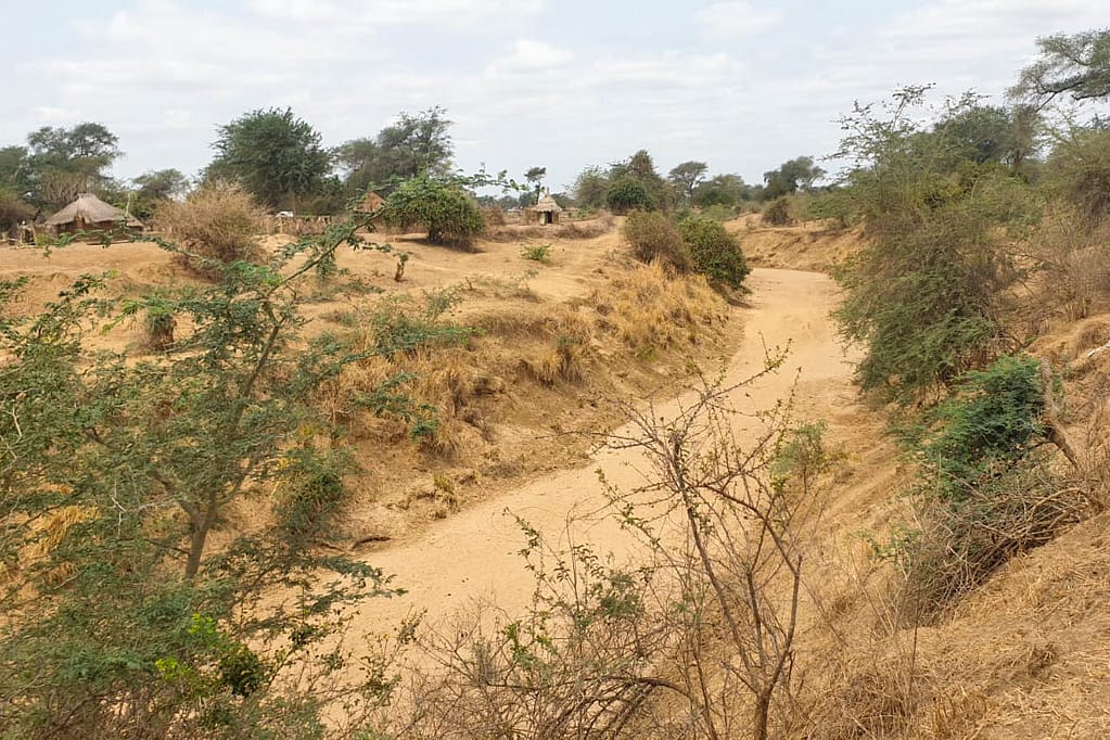
In Zambia’s Southern Province, the Magoye River often overflows during the rainy season, which inundates surrounding areas and causes widespread crop and infrastructure damage. Smallholder farmers, many of whom already live below the poverty line, are particularly vulnerable to the effects of natural disasters; the resulting crop failures from flooding events can push them deeper into poverty. It is therefore essential to develop solutions that address the damage caused by flooding and quickly compensate affected communities for flood-related losses.
One promising tool is Index-Based Flood Insurance, an innovative and low-cost insurance approach that pays out benefits based on a measurable pre-established index such as flood depths and duration.
The CGIAR Initiative on Diversification in East Africa and Southern Africa, Ukama-Ustawi identified bundling climate insurance as a potential valuable risk management solution for the region’s smallholder farmers. By mapping flood-prone agricultural areas and providing indexes for insurance, the farmers could receive timely insurance payouts to mitigate the financial risks associated with recurrent flooding.
The International Water Management Institute (IWMI) in collaboration with the Agriculture and Climate Risk Enterprise (ACRE Africa) and the Professional Insurance Company piloted Index-Based Flood Insurance (IBFI) among smallholder farmers residing along the Magoye River in three villages, Itebe, Munenga and Mwanachingwala.
The advantages of Index-Based Flood Insurance
Index-Based Flood Insurance (IBFI) is more beneficial than typical insurance as it helps beneficiaries receive compensation quickly without going through the often-lengthy process of damage assessments. Specifically, flood-index based insurance uses pre-determined triggers such as flood duration, flood depth or rainfall thresholds to dictate the size of payouts. Furthermore, bundling flood insurance with other climate resilience solutions such as drought insurance or input subsidies provides farmers with more comprehensive risk coverage.
IWMI researchers Yakob Umer, Mirriam Makungwe, Giriraj Amarnath, Inga Jacobs-Mata and their partners are developing an IBFI product for Zambia based on the simulated flood depth along the Magoye River. By utilizing physically based modelling techniques and Earth Observation data, the IBFI product is designed to provide risk coverage against losses due to floods. IWMI has already successfully deployed the IBFI concept using similar techniques in India and Bangladesh.
IBFI pilot during Zambia’s rainy season
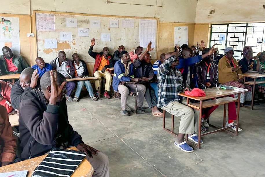
The IBFI pilot was conducted during the 2024-2025 rainy season and targeted 250 households in the Magoye Catchment. During consultations, farmers indicated that flooding had severely affected crop production in previous years; there was strong interest across the three villages in acquiring insurance for protection against losses.
The IWMI researchers created a model to simulate historical flooding from 2001 to 2023. This simulated flooding was then used to determine specific percentile thresholds that correspond to flood severity levels (minor, moderate, major and catastrophic). During the pilot program, the model’s performance was evaluated against observed flooding measured with in-situ gauges and satellite-monitored flood depth along the river.
The IBFI applied to individual pixels along the Magoye River; each participating farmer received around 1,786 Zambian Kwacha as the sum insured, equivalent to around $64. Insurance payouts were tiered based on flood depth percentiles. For example, minor flooding began at the 80th percentile with a maximum coverage of 25% while catastrophic flooding is triggered at the 99th percentile with a maximum coverage of 100%. Using this tiered system provides flexibility for insurers and ensures that farmers receive appropriate compensation that is proportional to the flooding.
Refined model to enhance climate resilience across the region
The monitoring of the flood levels concluded in March 2025 with an expected overall level of minor flood severity in the village. The post-flood flood model depths were shared with the insurance partners for the payout calculation; these payouts will be given to the participating farmers.
Overall, the researchers found that a combination of flood modeling, satellite data and multi-tiered payout systems allow IBFI to provide timely financial payouts for farmers, reducing economic shocks and increasing climate resilience.
They plan to further refine the flood model and data integration, ensuring greater accuracy between model outputs and satellite observations. Moving forward, they aim to scale IBFI across flood-prone regions in sub-Saharan Africa to strengthen the region’s climate and disaster resilience.


