Across Africa, water systems are changing faster than our ability to track and manage them. Land-use change, the rising demand for food and water, and climate variability are fast reshaping rivers, aquifers and urban watersheds.
Today, Earth Observation (EO) satellites monitor the Earth’s atmosphere and surface, while cloud platforms provide faster computational and data storage resources. These technological advancements give us access to detailed, near-real-time water data. However, this information has not consistently translated into better decisions. Many water institutions still lack the skills and workflows to turn data into meaningful action.
The Digital Innovations for a Water-Secure Africa (DIWASA) project, led by the International Water Management Institute (IWMI) with support from the Helmsley Charitable Trust, is working to close this gap by transforming EO data into practical water intelligence, while strengthening the capacity of local communities to put that information to use.
A new era of water intelligence
For decades, African governments and researchers have grappled with the same challenge: how to make sound water decisions in the absence of timely, reliable data. DIWASA responds by placing satellite-based insights directly in the hands of those who need them most.
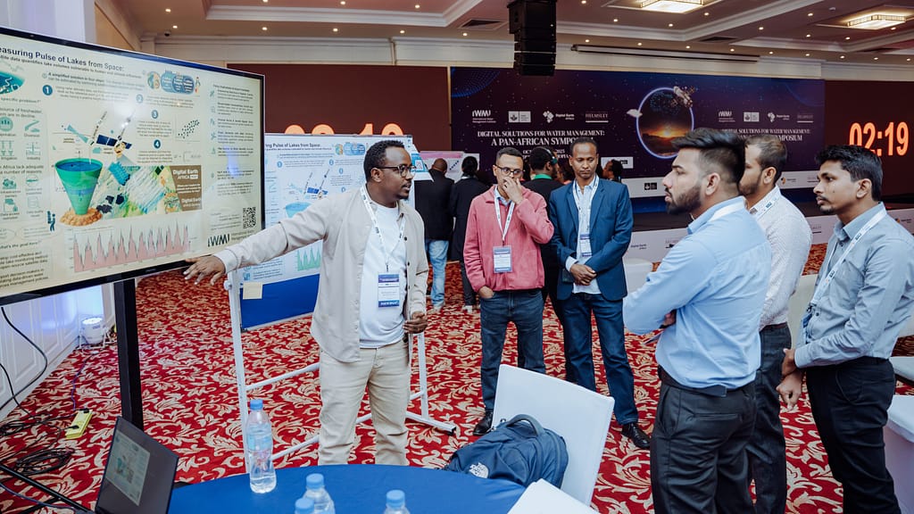
In Burkina Faso, Ethiopia, Ghana and Zambia, young researchers trained by DIWASA and Digital Earth Africa (DE Africa) are now monitoring reservoir levels, tracking water quality and identifying flood risks — tasks that once required expensive and time-consuming field missions. DE Africa is a platform that delivers decision-ready insights to planners and policy makers, using Earth observation tools to address social, environmental and economic challenges across Africa.
In Ghana, digital tools to estimate soil moisture in irrigation schemes and map coastal erosion are giving local officials a clearer picture of shoreline changes that threaten livelihoods and infrastructure.
In Zambia, EO-powered water balance assessments of basin and crop prediction models are helping basin authorities and farmers prepare for an increasingly unpredictable climate.
What is emerging is a new form of water intelligence: open, accessible and increasingly locally owned.
Impact in the community
One of DIWASA’s most notable achievements is its emphasis on community use cases. These are community-led solutions designed by African teams to address problems identified within their own countries and regions. These use cases begin with training local experts from public institutions using the DE Africa platform and are intentionally designed to measure impact on the ground.
DIWASA contributes datasets and training materials to Digital Earth Africa, which hosts a suite of satellite-derived data layers covering the entire African continent. These datasets are then used to turn raw Earth Observation imagery into analysis-ready information on land, water and vegetation. For example, maps that give information on monthly water presence over time, cropland extent, vegetation conditions and coastline change. These visualizations enable users to monitor environmental change, land use, water trends and natural resource dynamics for decision-making, research and sustainable development planning across the continent.
DIWASA’s training model combines in-person engagements with online learning using the DE Africa platform, allowing the initiative to reach participants across multiple countries, including those beyond the pilot locations. This blended approach has expanded access, strengthened technical capacity and enabled researchers from diverse contexts to collaborate and co-develop practical solutions.
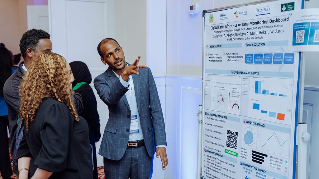
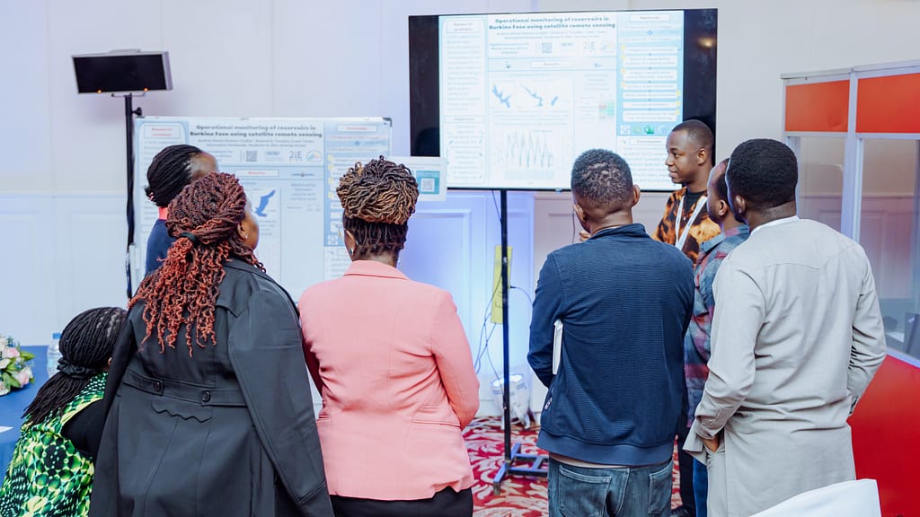
For example, Ethiopian researchers built a Land Use and Land Cover (LULC) classification tool for irrigated agricultural land mapping. In Burkina Faso, a community team developed a water level estimation tool for reservoirs, while a Ghanaian team built tools that estimate soil moisture in an irrigation scheme and detect the effectiveness of coastal erosion interventions, and a team from Zambia developed a water balance assessment approach at river basin scale.
Across all of these community use cases, a common thread stood out: each tool was designed locally, grounded in community priorities and powered by open Earth Observation data. For example, the small reservoir dashboard for northern Ghana provides insights on water availability and aquaculture suitability that guide rural development. The dashboard uses EO like Sentinel-2 imagery and machine learning to improve reservoir water-level estimation.
Digital innovation succeeds only when it is people centered. By investing in local talent, IWMI is supporting the emergence of a new generation of digital water stewards. These innovators are demonstrating that African-led data solutions do not merely replicate international tools — they improve them, adapt them and root them in local realities.
Africa’s water future is written in code and collaboration
Africa’s water challenges, from intensifying droughts and floods to growing pressure on finite resources, are accelerating. But the next chapter is no longer about proving that digital tools work; it is about scaling them, embedding them in policy, and expanding their reach across countries and institutions.
The focus now is on applying proven DIWASA use cases in new contexts, including Uganda and Sierra Leone, where data gaps and climate risks remain acute. At the same time, sustained capacity building for post-graduate students and early-career professionals ensures that these tools are not only adopted but also owned, adapted and advanced locally.
IWMI will play a central role in this transition, acting as a convener between science and policy, supporting governments in integrating DIWASA data products into planning and decision-making processes, and nurturing the next generation of African water scientists through hands-on training and mentorship.
Africa’s digital water revolution may be quiet, but it is moving decisively from pilots to practice, from isolated tools to institutional systems, and from promise to impact, reshaping what water security looks like across the continent.


