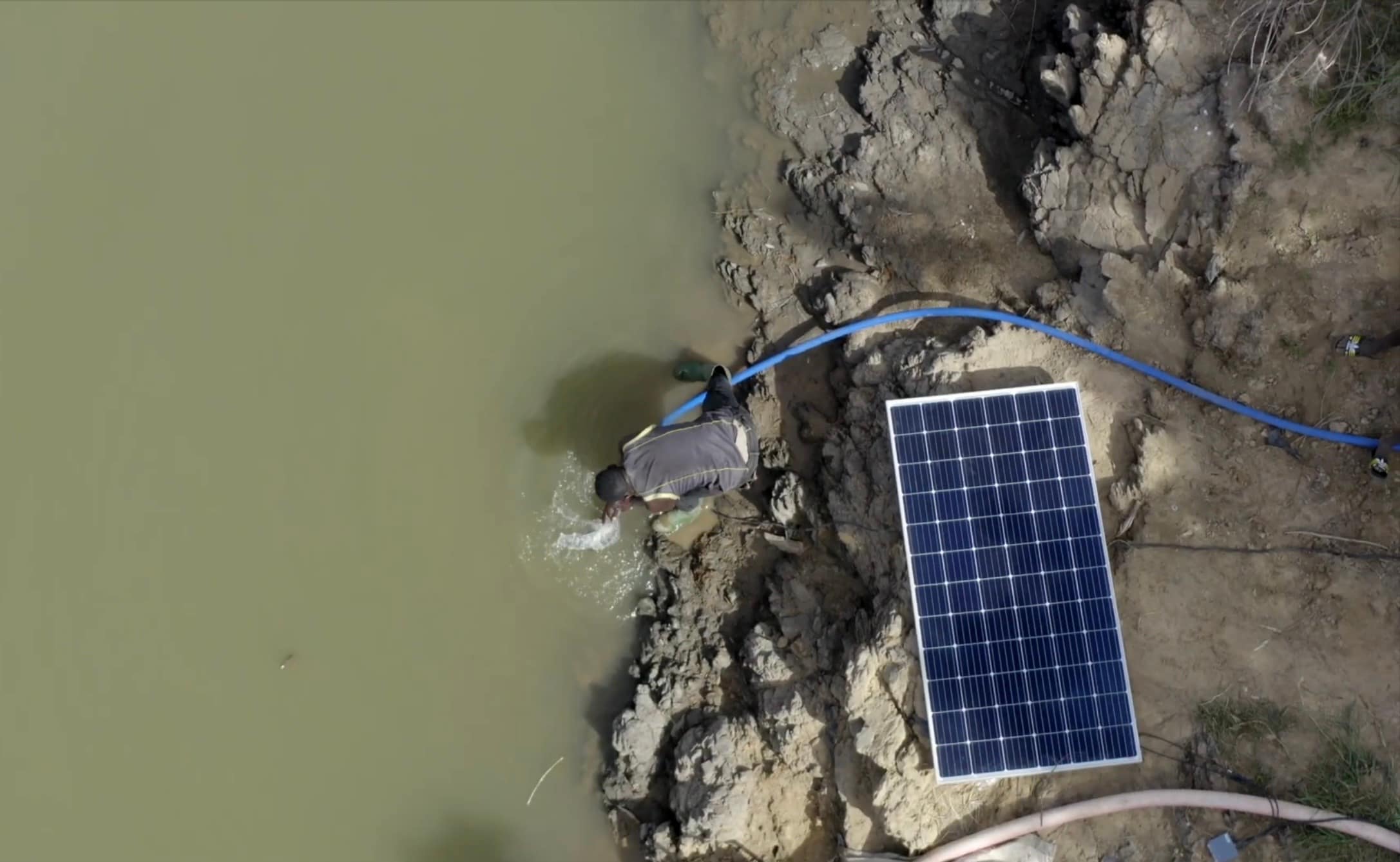
The International Water Management Institute (IWMI) transforms raw data into actionable insights that facilitate data-driven decision-making at every level — from continents and countries to counties, river basins, watersheds and sub-watersheds. It leverages Earth Observation data and digital innovation techniques to generate comprehensive information on water availability, scarcity and usage, as well as analyze water risks across multiple temporal and spatial scales throughout the Global South. The methods and frameworks developed by IWMI are inherently scalable, as they require minimal in situ observations, making them particularly well-suited for data-scarce regions.
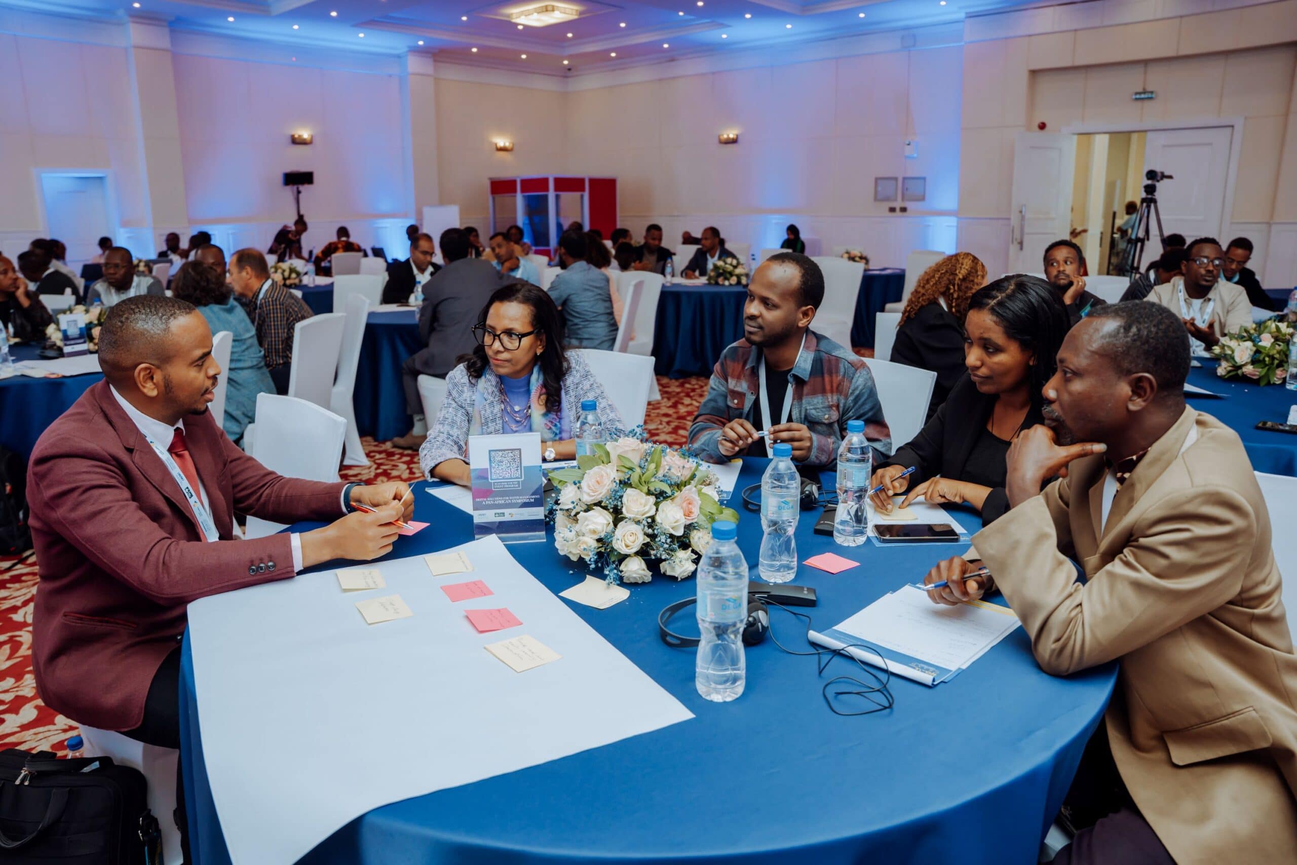
IWMI is committed to enhancing data dissemination through the creation of open data cubes, interactive dashboards and visualizations, complemented by proactive stakeholder engagement and targeted training initiatives. It works on capacity building and training stakeholders from multiple countries on the use of digital innovation technologies such as Earth Observation data, AI and Machine Learningapproaches and open-source frameworks. Its research and programs:
Assess water reuse prioritization, climate impact and water quality.
Develop dashboards that integrate real-time data and forecasts to provide visualization platforms for a variety of data types.
Perform advanced modeling to help decision-makers and communities with the data and information they need to make informed decisions and manage water resources effectively.
Create digital tools that perform functions such as water accounting, water productivity estimations and sustainable irrigation management.
Reservoirs play a significant role in the mobilization of water resources in Burkina Faso, contributing to the management and availability of water for various purposes. Operational management of reservoirs requires accurate and timely water level information, which remote sensing can provide cost-effectively and with limited resources. In this study, the surface area of 20 reservoirs is first determined using a Random Forest classifier and Sentinel-2 images acquired between 2015 and 2022. The accuracy of the classified surface water areas is evaluated by calculating 5 accuracy assessment metrics. The classifications were validated using manually digitized water areas from high-resolution Google Earth images and compared to the Dynamic World (DW) land cover dataset. Afterward, the spatial variation in the areal extent of the reservoirs is analyzed over time. A linear relationship is established between the estimated surface area and the corresponding observed water level of the reservoirs. The results indicate that reservoir surface areas were accurately classified with Sentinel-2 images (Kappa above 90.35%) for all dates. Moreover, validation with high-resolution images provided an R2 of 0.99 and a Normalized Root Mean Square Error (NRMSE) of 3.53%. Smaller reservoirs exhibit significant variations in surface areas over time as compared to larger ones, which are more stable. The relationship between surface area and water level is satisfactory (R2 ranging from 0.76 to 0.97) for 14 of the 20 analyzed reservoirs. The remaining six reservoirs are affected by aquatic plant intrusion which leads to an underestimation of the surface area. The high accuracy and operational feasibility of the proposed approach demonstrate that Sentinel-2 imagery and machine learning techniques can be recommended for reservoir mapping within the framework of water level monitoring in Burkina Faso.
Case studies / Time series analysis / Satellite imagery / Surface area / Surface water / Water reservoirs / Water levels Record No:H053816
Study region: Volta Basin
Study focus: Water management in transboundary basins is challenging due to the interaction of natural and human factors across political borders. The Volta River Basin, shared by six West African countries, exemplifies this with variable water distribution and socio-economic pressures. This study presents a comprehensive multi-scale water accounting of the basin, assessing water flows and usage at basin-wide, sub-basin, and riparian country scales from 2003 to 2021.
New hydrological insights for the region: The results reveal average basin closure is 55 % with room for additional water allocation given that utilizable water in the basin is 20 km3 /year and almost 25 % of the basin’s exploitable water is non-recoverable water (wastewater). Sub-basin analysis showed variations in average annual rainfall, ranging from 940 to 1250 mm/year, and groundwater recharge rates (18–64 mm/year), with southern sub-basins receiving more rainfall and having higher recharge rates. Similarly at the country level, variability in rainfall (630–1220 mm/ year) and recharge rates (20–280 mm/year) were noted, with downstream countries benefiting from higher rainfall and significant inflows from upstream countries. The analysis underscored the interconnectedness of water use across the basin’s riparian countries. The study’s findings give insights for the strategic management of water resources and the crucial need for enhanced cooperation among riparian countries to address shared challenges and opportunities in the Volta Basin.
Evapotranspiration / Rainfall / Water resources / Water allocation / Water management / International cooperation / Riparian zones / River basins / Transboundary waters / Water accounting / Water use / Water availability Record No:H053743
The Middle East and North Africa (MENA) region, with its arid and semi-arid climate, faces profound challenges in managing limited water resources. These challenges are further intensified by political tensions and socioeconomic inequalities, often resulting in water being an essential element in conflicts and tensions. Particularly during the last decade, the number of conflicts involving water has increased dramatically in MENA. This research explores the dynamics of water’s role in conflicts, actors and scales of conflict across five fragile MENA countries, where it serves as a weapon, a catalyst, and a casualty. The analysis revealed a significant increase in the number of water-related incidents during the last two decades in these countries, with devastating implications on multiple social, economic, and security dimensions. The study suggests a concentric circle transformation (CCT) framework with three tiers of strategies: foundational, supportive, and expansive to help move from water-conflict to water-peace in MENA. These strategies, with examples of interventions, support transformation to water-peace by integrating soft interventions like empowering local communities, raising awareness, with hard interventions such as building resilient infrastructures and leveraging the power of innovative technological solutions. The framework offers scalable and adaptable solutions for regions facing similar challenges globally.
Socioeconomic aspects / Political aspects / Climate change / Water availability / Water resources / Awareness-raising / Intervention / Strategies / Frameworks / Conflicts / Water scarcity Record No:H053695
The study explores the evolving land use patterns and their implications for sustainable development in Ghana and neighboring megacities. Using 15 years of historical Land Use and Land Cover (LULC) data combined with Land-Use Harmonization datasets, the study applies the Future Land Use Simulation (FLUS) model to project future LULC dynamics under Shared Socioeconomic Pathway (SSP) scenarios in the densely urbanized Greater Accra Region (GAR) of West Africa. Analyzing historical and current land use dynamics in the GAR revealed notable shifts, notably a decrease in Rangeland and an increase in Built-up areas. Future projections of LULC under SSP scenarios show continuous expansion of Built-up areas, particularly under SSP245 (middle of the road scenario) and SSP370 (Regional Rivalry scenario). This is consistent with results from the urban growth analysis using Urban Expansion Intensity Index (UEII), indicating high-speed expansion in baseline periods and shifts towards medium to high-speed expansion under SSP245 and SSP370 with low-speed expansion under the SSP126 (Sustainability scenario). Shannon entropy analysis shows dispersed urban sprawl, especially under SSP245 and SSP370, with rapid increases in Built-up areas and declines in green areas. For instance, the analysis of the landscape metrics reveal that built-up and green areas are projected to increase and decrease up to 87% and 12% respectively, under these scenarios. The decline in urban green areas was significantly influenced by proximity to the central business district (CBD), with green spaces diminishing more as distance to the CBD decreased. Therefore, relevant local legislation, such as the 2016 Land Use and Spatial Planning Act (Act 925) must be enforced, along with integrating urban initiatives and policies that promote green areas, is essential for ensuring the sustainability of urban ecosystems for the well-being of both humans and the environment. This enables West Africa to achieve its Global commitments as reflected in the UN SDGs, towards the New Urban Agenda (NUA) and the Africa Urban Agenda 2063.
Sustainable development / Simulation models / Projections / Land cover / Land use / Megacities / Urban development Record No:H053623